

'))
Geologyé çStratigraphy Vega HuertaèSurface Geology of the Western MassifThe Western Massif has been mapped and four major Variscan thrust sheets (or nappes). Each is overthrust on to the one immediately to the south so that the dip of the thrusts generally increases from south to north. Vega Huerta is located on the first (most southerly) nappe to be emplaced which is called the Frontal Nappe Unit. The highest mountain in the massif, Pena Santa, is located at the front of the second nappe, the Pena Santa Nappe Unit. Within the Frontal Nappe Unit the dips of the beds is generally 0° to 20º although the dip reaches 30° at the southern escarpment and steeper dips occur near major faults. This contrasts with the area to the north and around Treviso where the dip is rarely less than 45º. 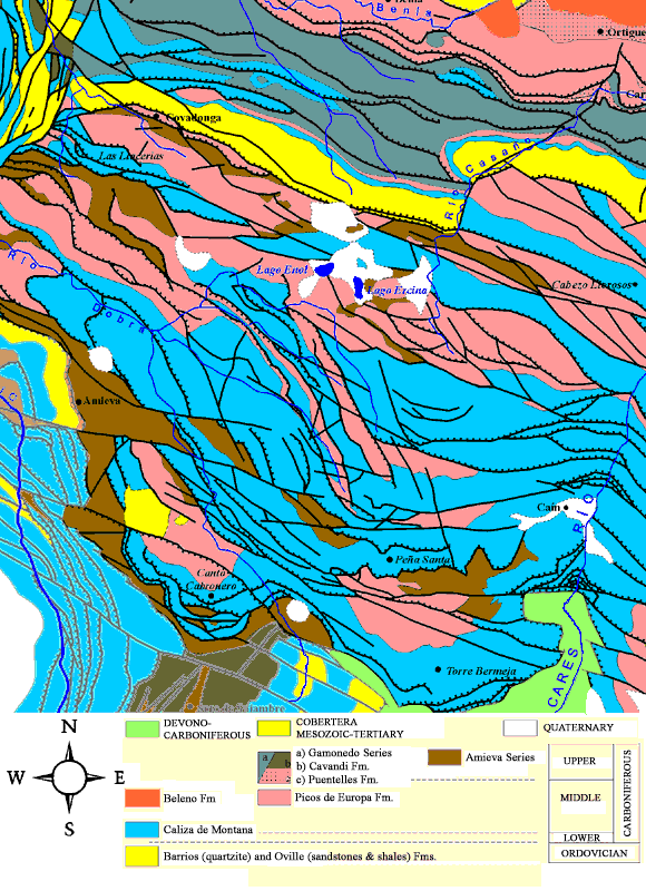
Geologyé çStratigraphy Vega HuertaèBibliography
|
